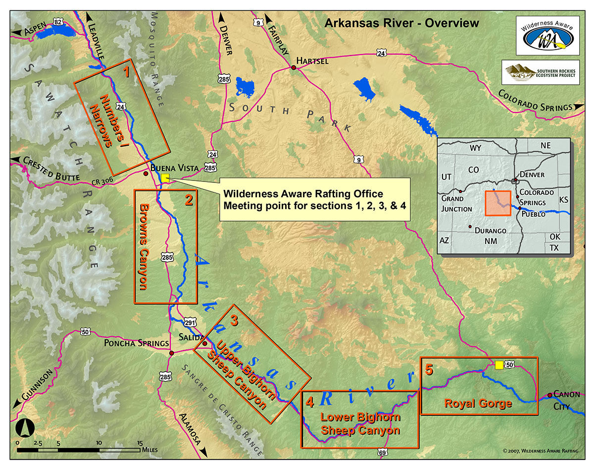
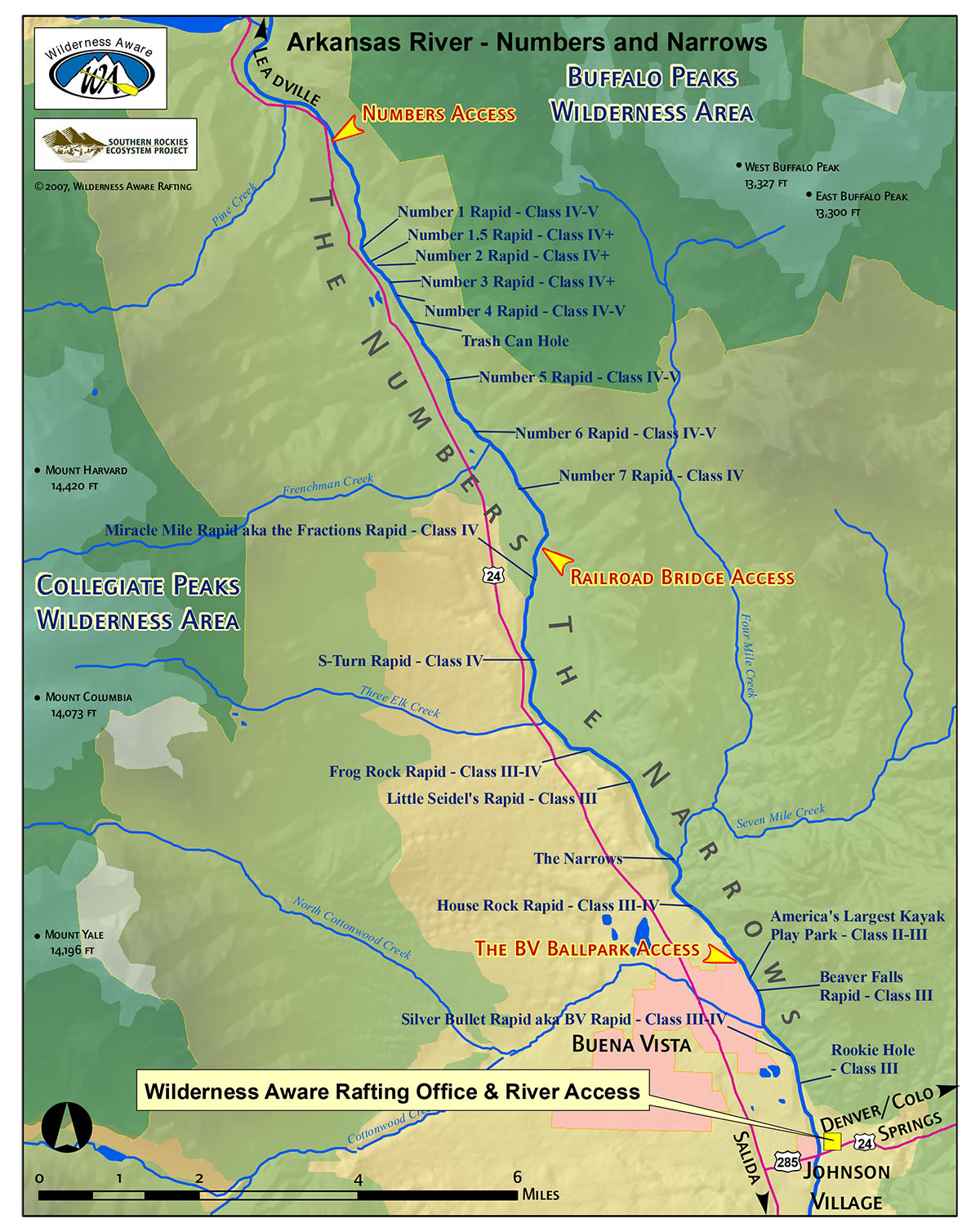
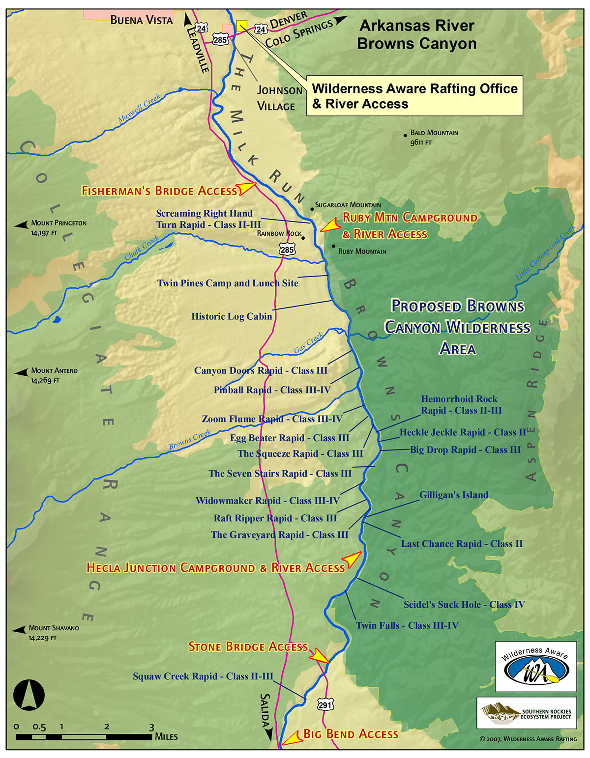
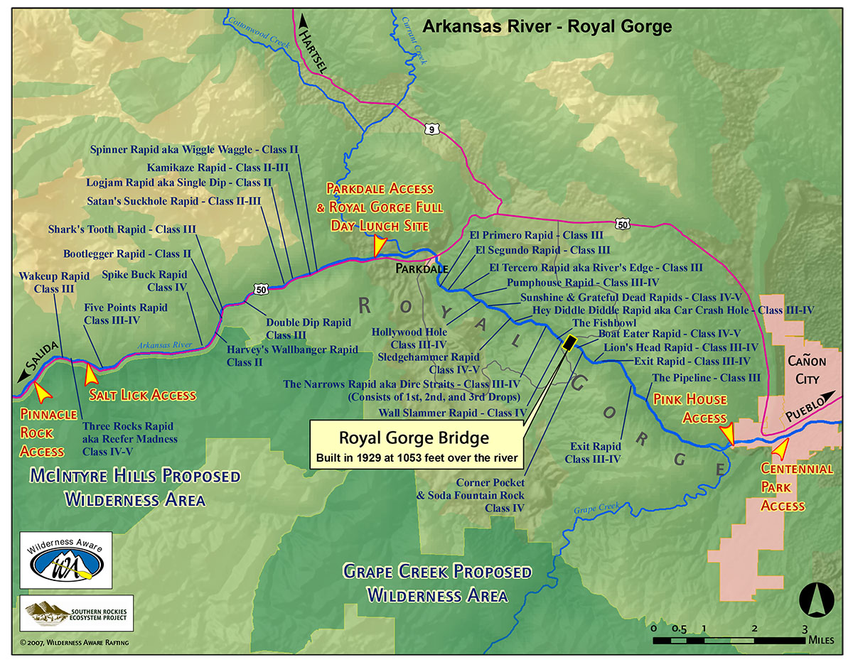
Explore the twists and turns of the Arkansas River with our detailed Arkansas River maps. Navigate your adventure through serene Colorado landscapes and challenging rapids, ensuring a thrilling journey from start to finish. Whether you’re planning Arkansas River whitewater rafting, a scenic Browns Canyon rafting trip, a thrilling Numbers rafting run, an adrenaline-pumping Royal Gorge rafting run, or multi-day Arkansas River overnight rafting trips, these maps provide essential information on river routes, access points, and key features along the way—perfect for planning your next rafting or kayaking adventure.
Choose from a variety of Colorado rivers, day trips, and multi-day trips to find just the right option for you and your crew. Better hustle, because they’re booking up quick!