
Arkansas River Water Levels & Snowpack Guide: When to Raft in 2026
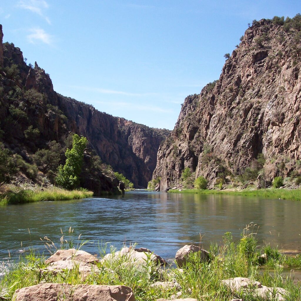
Arkansas River water levels in 2026 are running below historical averages, but that doesn’t mean the season is a wash. Thanks to the dam-controlled river system and the Voluntary Flow Management Program, Wilderness Aware is planning a full May-September season with trips for every experience level. Here’s what you need to know about snowpack, river flow, and the best months to book your trip. 2026 Arkansas River Snowpack: What It Means for River Flow Colorado snowpack is the engine behind the Arkansas River’s annual flow cycle. As mountain snow accumulates through winter, it acts as a natural reservoir, releasing water gradually into the river basin as temperatures rise in spring and early summer. In 2026, Colorado snowpack finished the winter at historically low levels, with most mountain areas reporting less than 50% of normal averages, according to the Natural Resources Conservation Service. For Arkansas River flow near Salida and Buena Vista, this means an earlier and shorter peak runoff window. Instead of flows cresting in mid-June (as in a typical year), the 2026 Arkansas River flow forecast calls for peak levels arriving in late May, followed by a faster drop into summer. Streamflows at the Wellsville Gauge are projected at roughly half of median for much of the season. Key Advantage: Unlike free-flowing rivers across Colorado, the Arkansas River is bolstered by Pueblo Reservoir and Twin Lakes Reservoir upstream. These structures store water and release it strategically, extending the rafting season well beyond what snowpack alone could support. The result: while rivers like the Yampa, Eagle, and Blue may face dramatically shortened seasons in 2026, the Arkansas remains Colorado’s most reliable commercial rafting river from late April through late September. The Voluntary Flow Management Program The Voluntary Flow Management Program is an industry-coordinated initiative that supplements the river with targeted reservoir releases, maintaining a minimum of 700 CFS at the Wellsville Gauge from July 1 through August 15. It keeps Browns Canyon and family trips operational through the heart of summer, even in low-snowpack years like 2026. Think of it as a safety net that extends the Arkansas rafting season well beyond what mountain snow alone could support. Could El Niño Boost Arkansas River Flow This Summer? Here’s some good news hiding in the 2026 forecast. Colorado summers bring afternoon thunderstorms through July and August, a season locals call the monsoon. This year, forecasters are calling for a stronger and more active monsoon than usual, which means more frequent afternoon rain across the mountains above the Arkansas River. That rain feeds directly into the river and can push water levels noticeably higher during the months that typically run lowest. Think of it as a natural top-off. Even if spring snowpack was thin, a wet July and August can keep rapids lively and flows consistent well into late summer. Wilderness Aware’s guides track conditions daily, so if the monsoon delivers, you may step onto the water and find more whitewater than you were expecting, in the best possible way. Lower Water Doesn’t Mean a Lesser Trip If you’ve never rafted before, you might assume less water means less fun. It’s actually the opposite. When the river runs lower, more rocks, ledges, and drops become visible, and your guide has to navigate around and through them. That precision is what makes lower-water rafting feel so engaging. At higher flows, the river moves fast and covers everything in big waves. At lower flows, you see the river working. Your guide reads each rapid before you hit it, positions the raft, calls out paddle strokes, and threads you through features that are unique to that day’s water level. Guests often say it feels more hands-on, like you’re actually part of making the trip happen. Lower water is also genuinely safer, especially for first-timers. The current is calmer, the rapids are more predictable, and if anyone goes for an unplanned swim, getting back to the raft is straightforward. Our guides are trained for every water level on the Arkansas, and they’ll match your group to a trip that fits, whether you’re looking for a gentle family float or something with a little more splash. Best Months to Raft the Arkansas River by Experience Level Not all flows are created equal, and neither are rafters. Arkansas River water levels shift significantly from April through September, creating distinct windows that favor different skill sets. Use this guide to match your group to the right month. Month Approx. CFS (Salida) Beginner / Family Intermediate Advanced April 300–800 CFS Limited — Milk Run only Browns Canyon (early) Numbers (if flows allow) May 800–2,500 CFS Lower Browns / Milk Run ✓ Browns Canyon ✓✓ Numbers / Royal Gorge ✓ June 1,500–4,000+ CFS* Lower Browns / Milk Run ✓ Browns Canyon ✓✓ Numbers / Royal Gorge ✓✓ July 700–1,800 CFS All family trips ✓✓ Browns Canyon ✓✓ Royal Gorge / Numbers ✓ August 500–1,000 CFS Best month for families ✓✓ Browns Canyon ✓✓ Royal Gorge (technical) ✓ September 400–800 CFS Milk Run / Lower Browns ✓ Browns Canyon ✓ Royal Gorge (scenic) ✓ * June CFS can vary significantly in high vs. low snowpack years. In 2026, expect flows on the lower end of the June range. CFS figures are approximate and based on historical Wellsville Gauge data. April: Early Season — Advanced Rafters Only Arkansas River flow in April is driven almost entirely by residual snowpack melt and overnight temperature swings. In 2026, with reduced mountain snowpack, early season flows near Salida may range from 300 to 800 CFS. Wilderness Aware offers limited early-season trips for experienced groups when conditions allow. The Numbers section may run during brief high-flow windows, while Browns Canyon opens as flows build. May: High Water Arrives — Best for Intermediate to Advanced May marks the start of Arkansas River peak season as snowmelt accelerates. In 2026, this peak is arriving earlier than usual, potentially by mid-to-late May, making it the prime window for thrill-seekers before flows begin to drop. Browns Canyon runs powerfully; the
Arkansas River: Come for the Rafting, Stay for the Trout!

Updated April 2026 The Arkansas River is widely known for its incredible whitewater rafting, but what many people don’t realize is that it’s also one of the best trout fisheries in Colorado. For those planning a visit, it’s worth thinking beyond just a single day on the river. A Gold Medal Trout Fishery Before even getting into a raft, it’s worth knowing that the Arkansas River is designated as a Gold Medal trout fishery. This classification is reserved for rivers that support both high fish populations and quality size, making it one of the more consistent fishing destinations in the state. Anglers can expect: Healthy populations of brown and rainbow trout Numerous public access points along the river Productive fishing conditions throughout much of the year It is common to see anglers casting in calmer stretches of the same river that produces whitewater just upstream. For many visitors, fishing becomes just as memorable as time spent in the rapids. World-Class Rafting on the Arkansas River Flowing through the heart of Colorado, the Arkansas River offers a wide range of rafting experiences, from beginner-friendly stretches to more technical and challenging whitewater. Sections like Browns Canyon, the Numbers, and the Royal Gorge each provide something different, whether you’re looking for scenic floating, continuous rapids, or steeper drops through a dramatic canyon setting. More Than Just a Day Trip While many visitors experience the Arkansas River on a half or full day trip, spending more time on the water offers a different perspective. Multi-day rafting trips allow for a slower pace, with time to enjoy the surroundings beyond the rapids themselves. Evenings along the river tend to be quieter, and the overall experience becomes less about rushing from one rapid to the next and more about being immersed in the environment. For a general idea of how these longer trips are structured, you can browsespecialty and multi-day options. Combining Rafting and Fishing One of the unique aspects of the Arkansas River is how naturally rafting and fishing can fit into the same trip. Faster-moving sections often transition into slower water, creating opportunities to experience both activities without needing to travel far. Some visitors choose to: Raft one day and fish the next Split time between activities in different sections of the river Extend their stay to explore more of the valley This flexibility is part of what makes the Arkansas River such a well-rounded destination. Planning Your Visit River conditions on the Arkansas vary depending on the time of year, largely driven by snowmelt and seasonal flows. Spring and early summer typically bring higher water and more intense rapids Mid to late summer offers more moderate flows Fall often brings lower water, fewer crowds, and strong fishing conditions A River Worth Slowing Down For The Arkansas River stands out because it offers more than just a single type of experience. It is a place where fast-paced whitewater and quiet moments on the water exist side by side. Whether you are there for a day or a few, it is the kind of river that often rewards staying just a little longer.
Things to Do With Kids in Buena Vista, Colorado: The Complete Family Guide
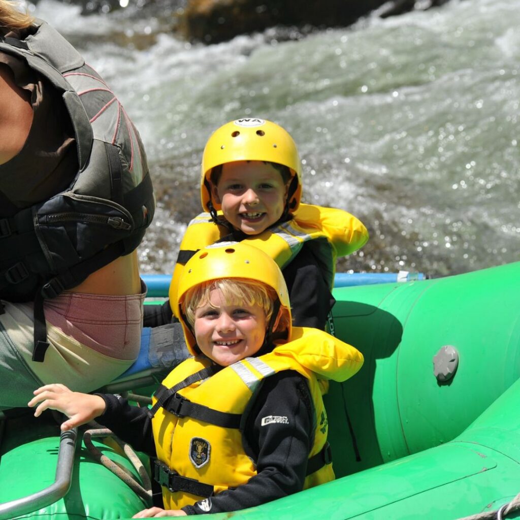
Quick Answer: Best Things to Do With Kids in Buena Vista, CO The top family-friendly activities in Buena Vista, Colorado include whitewater rafting, soaking at Mt. Princeton Hot Springs, exploring Buena Vista River Park, hiking family trails near Browns Canyon National Monument, camping under the stars near the Collegiate Peaks, and visiting the Jumpin’ Good Goat Dairy. Buena Vista is one of Colorado’s best family vacation destinations, with activities suited for kids as young as 2 and teens alike. If you’re searching for the perfect Colorado family vacation, look no further than Buena Vista. Nestled between the Collegiate Peaks and the Arkansas River in central Colorado, “BV” is a mountain town that punches far above its weight when it comes to things to do with kids. Whether your crew is full of toddlers or teenagers, thrill-seekers or nature lovers, Buena Vista delivers an adventure for everyone. Here at Wilderness Aware Rafting, we’ve been guiding families down the Arkansas River for decades. We know this area inside and out — so we put together this comprehensive guide to the best things to do with kids in Buena Vista, Colorado, covering everything from world-class whitewater rafting to goat farms and hot springs. 1. Family Whitewater Rafting on the Arkansas River TOP PICK FOR FAMILIES More than 250,000 people visit Buena Vista each year specifically to raft the Arkansas River — and for good reason. The Arkansas is consistently ranked among the top whitewater rivers in the United States, and it has stretches perfectly suited for every age and experience level. For families with young children ages 4 and up, our Family Rafting Trip on the Milk Run or Lower Browns Canyon (Class I–II) is a dream introduction to river life. Kids giggle through gentle splashes, spot wildlife along the canyon walls, and come away with big grins and bigger stories. For families with kids ages 6 and up, the iconic Browns Canyon rafting trip through Browns Canyon National Monument delivers Class III whitewater that’s exciting without being overwhelming. Named rapids like Zoom Flume, Pinball, and the Staircase will have the whole family cheering. Trip Min. Age Difficulty Duration Starting Price Milk Run (Family Float) Ages 4+ Class I–II Quarter-day Starting at $62/person Lower Browns Canyon Ages 4+ Class I–II Half-day Starting at $62/person Browns Canyon Ages 6+ Class III Half-day or full-day Youth from $89/person ???? Pro Tip: Rafting season runs May through Labor Day. June and July bring the most exciting flows after snowmelt from the Collegiate Peaks. Book early — summer dates fill up fast, especially on weekends. 2. Mt. Princeton Hot Springs Resort PERFECT AFTER A BIG ADVENTURE DAY Just nine miles south of downtown Buena Vista, Mt. Princeton Hot Springs is a must-do for any family visiting the area. These geothermal waters have drawn visitors for nearly 150 years — and for good reason. The resort features multiple pool areas ranging from relaxing soaking pools and exercise pools to the wildly popular natural creekside pools along Chalk Creek, where kids can move rocks around to mix warm spring water with cool creek water and find their perfect temperature. The biggest draw for kids? A water slide that descends the hillside into a warm pool — a highlight the whole family will be talking about long after the trip is over. It’s open seasonally during summer months, with an additional fee to ride. ???? Pro Tip: Mt. Princeton is open 365 days a year, making it an excellent choice even if you’re visiting Buena Vista outside of summer. Pair it with a morning rafting trip for a perfect full-day family itinerary. 3. Buena Vista River Park & the BV Boulder Garden FREE FAMILY FUN The Buena Vista River Park is the heart of outdoor life in BV, and it’s completely free to visit. Running along more than half a mile of the Arkansas River in the South Main neighborhood, this world-class park packs in an incredible amount for families: BV Boulder Garden — hand-sculpted concrete bouldering structures designed for all skill levels; a fantastic intro to climbing for kids Skate park for the older kids and teens Ball fields, disc golf, and running/walking tracks Picnic tables with front-row views of kayakers tackling the whitewater park A dog-friendly area for the family pup The adjacent South Main neighborhood is also worth exploring on foot, with local shops, food trucks, and the popular LAWN event space where the Surf Hotel hosts live summer concerts perfect for families. ???? Pro Tip: There’s also a splash park near the corner of Railroad and Main Street — a great way to cool off with little ones on a warm afternoon. 4. Hiking Family-Friendly Trails Near Buena Vista GREAT FOR ALL AGES Buena Vista sits at the base of the Sawatch Mountain Range — home to more 14,000-foot peaks (14ers) than any other range in Colorado. You don’t need to summit a 14er to experience this dramatic landscape, though. The area has excellent family hiking for every ability level. Barbara Whipple Trail — A gentle, accessible path that’s great for younger kids and strollers; runs along the river with beautiful views. Midland Hill Trail / Bridge to Bridge Loop — Moderate trails near South Main offering sweeping panoramic views of the Collegiate Peaks. Perfect for families with older kids. Browns Canyon National Monument Trails — Hike into the canyon and see the same granite walls and wildlife — bighorn sheep, prairie falcons, and elk — that rafters float past. A short 10-minute drive from downtown BV. Cottonwood Lake Trail — A 3.3-mile round trip at nearly 12,000 feet elevation. Manageable for kids with only 423 feet of elevation gain, and the alpine views are breathtaking. ???? Pro Tip: Colorado’s high altitude sun is intense. Pack sunscreen, hats, and plenty of water no matter how short the hike — and start early to avoid afternoon thunderstorms, which are common in summer. 5. Camping & Staying Overnight Near the River CLASSIC COLORADO FAMILY EXPERIENCE Few things
The Ultimate Guide to Camping Near Buena Vista, Colorado
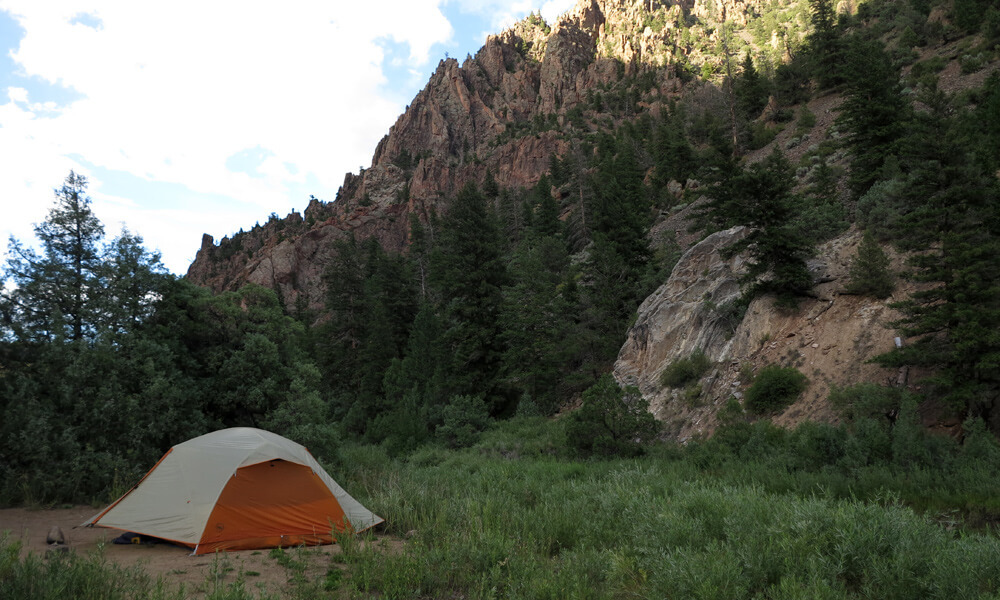
Looking for camping near Buena Vista? You’ve come to the right place! Nestled in the heart of the Colorado Rockies, Buena Vista is a charming town known for its stunning natural beauty and its reputation as an outdoor adventure hub. With its proximity to the Arkansas River and the surrounding mountains, Buena Vista offers a variety of camping options, from established campgrounds to dispersed camping areas. Many visitors also explore activities like hiking, fishing, and white water rafting in Colorado on the Arkansas River during their stay. Whether you’re seeking a peaceful retreat or an adrenaline-filled adventure, Buena Vista has something for everyone. In this guide, we’ll explore the best camping near Buena Vista, including dispersed camping near Buena Vista, CO and Arkansas River camping. Table of Contents Established Camping near Buena Vista Buena Vista offers a variety of campground options ranging from full-service RV parks to quieter mountain campgrounds. Whether you’re looking for convenient RV amenities or a peaceful place to pitch a tent, the Buena Vista area has plenty of great camping spots to choose from. 1.Arrowhead Point Campground and RV Park Located just south of Buena Vista, Arrowhead Point Campground and RV Park is nestled in a picturesque setting with stunning views of the surrounding mountains. It offers a variety of camping options, including RV sites, tent sites, and cabins. The campground features amenities such as full hookups, hot showers, laundry facilities, a swimming pool, a playground, and a camp store. It’s a great choice for families and groups looking for a well-equipped campground. 2. Cottonwood Lake Campground Located just west of Buena Vista, Cottonwood Lake Campground offers a serene camping experience. With picturesque views of the lake and the surrounding peaks, this campground is a popular choice for anglers and nature lovers. Amenities include picnic tables, fire rings, vault toilets, and potable water. 3. Chalk Creek Campground Situated along Chalk Creek, this campground offers a tranquil setting with stunning mountain vistas. It features spacious campsites, fire pits, picnic tables, and vault toilets. Enjoy fishing in the creek or simply relax and take in the natural beauty that surrounds you. 4. Mt. Princeton RV Park For those looking for a more comfortable camping experience, Mt. Princeton RV Park offers full-hookup RV sites and tent camping options. The park boasts amenities such as hot showers, laundry facilities, a playground, and a game room. It’s an excellent basecamp for exploring the area’s attractions. 5. Snowy Peaks RV Park If you’re looking for comfortable camping near Buena Vista with modern amenities, Snowy Peaks RV Park is an excellent choice. It offers full-hookup RV sites, tent sites, and even cozy cabins for rent. The park provides amenities like hot showers, laundry facilities, a playground, a dog park, and a camp store. With its convenient location near Buena Vista, you can easily explore the town’s attractions and outdoor activities. Dispersed Camping near Buena Vista, CO Buena Vista offers plenty of dispersed camping opportunities in the nearby national forests, giving campers the chance to enjoy a quieter and more remote outdoor experince. Many of these sites are just a short drive from Buena Vista and provide easy access to hiking trails, scenic viewpoints, and the Arkansas River. When dispersed camping, be sure to follow regulations and practice Leave No Trace principles to protect these beautiful landscapes. Some popular dispersed camping areas include: Fourmile Recreation Area Baldwin Lake Cottonwood Pass Road Many campers choose dispersed sites around Buena Vista for their easy access to the Arkansas River and other outdoor recreation throughout the valley, including opportunities for Colorado white water rafting along the Arkansas River. Arkansas River Camping The Arkansas River is a renowned destination for water enthusiasts visiting the Buena Vista area. Several campgrounds provide easy access to the river for fishing, kayaking, and rafting adventures. Ruby Mountain Campground: Located near the town of Nathrop, Ruby Mountain Campground offers riverfront Arkansas River camping spots. It’s a great option for visitors who want to stay close to the river and enjoy the surrounding scenery Some of the most scenic Arkansas River camping spots are located along remote stretches of the canyon and are often accessed during Colorado rafting trips. Multi-day rafting adventures allow visitors to experience the river from a different perspective while camping along its banks. Wilderness Aware is one of the leading Buena Vista rafting companies and offers multi-day rafting trips ranging from 2 to 5 days, combining exciting whitewater with riverside camping in one of Colorado’s most beautiful river corridors. Planning Your Buena Vista Camping Adventure Camping near Buena Vista offers endless opportunities to explore the surrounding mountains, rivers, and scenic landscapes. From quiet dispersed campsites to well-equipped campgrounds, the area provides a perfect basecamp for outdoor adventures throughout the Arkansas River Valley. Many visitors combine camping with time on the river, whether that means relaxing by the water, exploring nearby trails, or experiencing white water rafting near Buena Vista, Colorado. With its mix of mountain scenery and river recreation, Buena Vista is one of the best destinations in Colorado for an unforgettable outdoor getaway. Camping Near Buena Vista FAQ Where can you camp near Buena Vista, Colorado? There are many options for camping near Buena Vista, including established campgrounds like Cottonwood Lake Campground and Ruby Mountain Campground, as well as dispersed camping areas in nearby national forests. Can you camp along the Arkansas River near Buena Vista? Yes. Several campgrounds and dispersed camping areas provide access to the Arkansas River, making it easy to enjoy fishing, kayaking, and whitewater rafting in Colorado during your stay. What is the best time of year for camping near Buena Vista? Late spring through early fall is the most popular time for camping. Summer offers warm weather and full access to outdoor recreation across the Arkansas River Valley. Are there Buena Vista rafting trips near local campgrounds? Yes. The Arkansas River runs directly through the area, and many visitors combine camping trips with Colorado rafting trips through Browns Canyon and other scenic stretches
Top Arkansas River Off-Season Activities
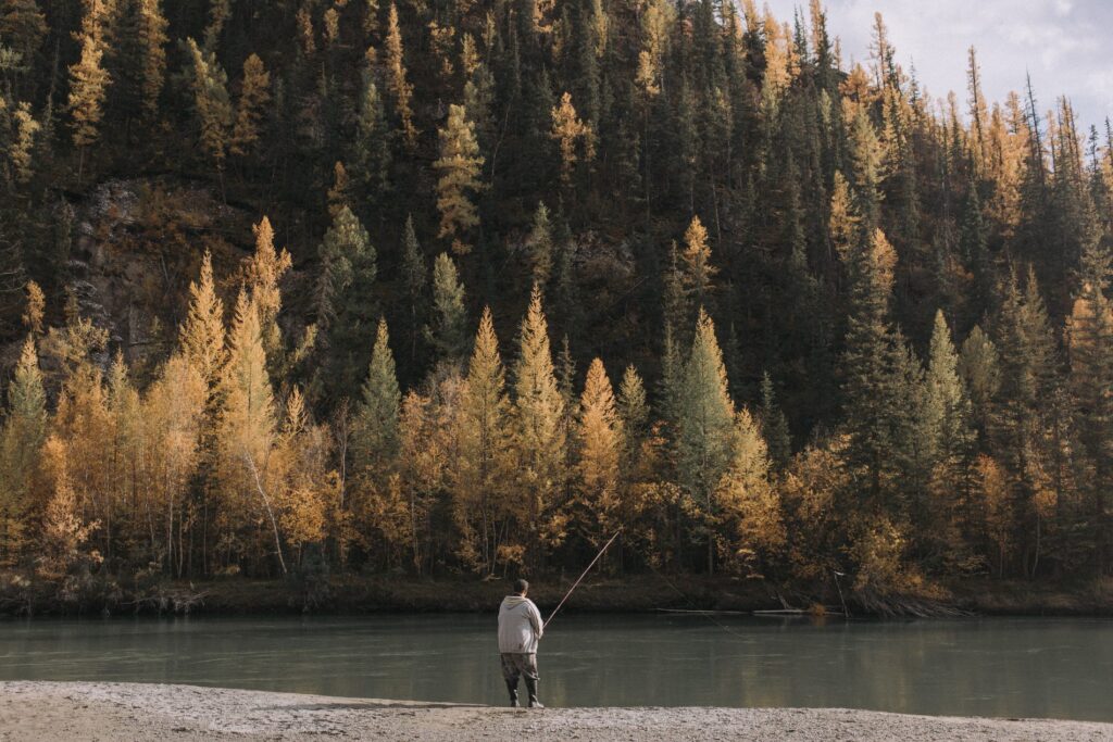
Published: April 25, 2025 | Updated: February 2026 While the Arkansas River is famous for its world-class whitewater rafting from May through September, the Arkansas River Valley doesn’t slow down when the raft season ends. Autumn and early winter offer a “quiet season” where the crowds thin out, the wildlife emerges, and the landscape transforms. Whether you are visiting Buena Vista or Salida, here are the best ways to experience the Arkansas River corridor during the off-season. Gold Medal Fishing The waters of the Arkansas River may be too shallow to raft by October, but lower levels create world-class conditions for end-of-the-season fly fishing. This stretch of the river is designated as “Gold Medal Water,” and the fall is a prime time for anglers. What to Catch: Brown trout and Kokanee salmon will be spawning, with Rainbow trout, Cutthroat trout, and Northern pike active as well. Where to Go: If the temperature permits, try fishing upstream of Salida. If you’re unfamiliar with the area, we recommend finding a local outfitter to guide you to the “honey holes.” Late-season fishing often means you’ll have a beautiful stretch of the river entirely to yourself. High-Altitude Hiking & The Colorado Trail Cooler temperatures and bright Colorado sunshine make autumn the perfect time to explore the best trails in the Arkansas River Valley. The crown jewel of local hiking is the 485-mile Colorado Trail, which passes directly through Salida and Buena Vista. While you likely won’t hike all 485 miles in one go, the trail is broken into manageable segments. These sections deliver breathtaking views of the Sawatch Range and the Arkansas River winding through the valley below. Wildlife Spotting As the high peaks begin to see snow, many of Colorado’s most iconic animals move to lower elevations near the river. Set out with your camera (and a zoom lens) to catch a glimpse of: Rocky Mountain Bighorn Sheep: The state mammal of Colorado! They love the steep cliffs of Bighorn Sheep Canyon. Pronghorn: Often mistaken for antelope, the pronghorn’s closest living relative is actually the giraffe. They are a true Colorado sight to see in the open meadows of the valley. Note: Always keep your distance and maintain respect for these animals in their natural habitat. Dark Sky Stargazing The Arkansas River Valley is home to some of the darkest skies in the state. Once the sun sets, find a spot along the Arkansas River away from city lights to watch the Milky Way emerge. The Stone Bridge river access north of Salida is a local favorite for guaranteed dark skies. Be sure to check the weather forecast before heading out; a cloudy sky can hide even the most impressive celestial display. Arkansas River Valley Off-Season Frequently Asked Questions When does the rafting season end on the Arkansas River? The Arkansas River rafting season typically runs from mid-May through Labor Day. While some high-water years allow for rafting into September, the river usually becomes too shallow for rafts by October, transitioning into a premier destination for fishing and hiking. What is the best month for fall colors in the Arkansas River Valley? The “peak” for fall colors in Buena Vista and Salida usually occurs between late September and mid-October. The golden Aspens are most vibrant in the higher elevations of the Sawatch Range, while the cottonwoods along the Arkansas River turn a deep gold shortly after. Can you see bighorn sheep in the Arkansas River Valley year-round? Yes, but they are most easily spotted during the off-season. In the fall and winter, bighorn sheep often descend to the river banks in Bighorn Sheep Canyon to find water and grazing land, making them highly visible from the roadside. The Arkansas River rafting season typically runs from mid-May through Labor Day. While some high-water years allow for rafting into September, the river usually becomes too shallow for rafts by October, transitioning into a premier destination for fishing and hiking. The “peak” for fall colors in Buena Vista and Salida usually occurs between late September and mid-October. The golden Aspens are most vibrant in the higher elevations of the Sawatch Range, while the cottonwoods along the Arkansas River turn a deep gold shortly after. Yes, but they are most easily spotted during the off-season. In the fall and winter, bighorn sheep often descend to the river banks in Bighorn Sheep Canyon to find water and grazing land, making them highly visible from the roadside.
How Browns Canyon Became a National Monument
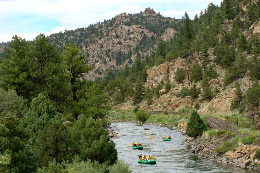
Published: June 23, 2017 | Updated: February 2026 Table of Contents On February 19, 2015, Browns Canyon officially became a National Monument, protecting 21,000 acres of Colorado wilderness for future generations. Nearly a decade later, this stretch of the Arkansas River between Buena Vista and Salida stands as one of Colorado’s greatest conservation success stories—and one of the world’s premier white water rafting destinations. From its rugged granite cliffs to the roaring Arkansas River carving through its heart, Browns Canyon is more than just jaw-dropping scenery. It’s a nationally protected treasure that took decades of advocacy, compromise, and grassroots support to preserve. Here’s how it happened—and what monument status means for visitors today. How Browns Canyon Became a National Monument at a Glance: Designated: February 19, 2015 by President Barack Obama Size: 21,586 acres of protected wilderness Location: Between Buena Vista and Salida along the Arkansas River Managed by: Bureau of Land Management (BLM) and U.S. Forest Service Best known for: World-class white water rafting, hiking, fishing, and wildlife viewing A Wild Canyon Worth Protecting Located between Buena Vista and Salida, Browns Canyon has long been beloved by hikers, anglers, rafters, and wildlife watchers alike. Its dramatic topography—sculpted by glaciers, volcanic activity, and the ever-powerful Arkansas River—makes it one of the most visually striking and ecologically diverse canyons in Colorado. But for years, Browns Canyon lacked federal protection, leaving its delicate ecosystem vulnerable to development, overuse, and resource extraction. As outdoor recreation in Colorado exploded, so did the pressure to preserve this untamed pocket of wilderness for future generations. The Long Road to Monument Status Efforts to protect Browns Canyon stretch back to the 1970s. Conservation groups, local businesses, and outdoor enthusiasts spent decades pushing for stronger protections. It wasn’t easy. Multiple proposals for wilderness or monument designations stalled in Congress due to political gridlock, competing land-use interests, and resistance from extractive industries. But the tide began to turn in the early 2000s when growing bipartisan support from local leaders, guides, outfitters, and residents pushed the cause forward. These weren’t just environmentalists—they were Coloradans who relied on Browns Canyon for jobs, outdoor adventure, and quality of life. Monument Designation by Presidential Proclamation On February 19, 2015, President Barack Obama officially designated Browns Canyon National Monument via the Antiquities Act. The move protected over 21,000 acres of public lands, ensuring Browns Canyon would remain a haven for hiking, rafting, fishing, camping, and wildlife for generations to come. “It’s not surprising that Coloradans have long felt a special connection to Browns Canyon,” Obama said during the announcement. “Today we’re going to protect this outdoor treasure for future generations.” – President Barack Obama What Monument Status Means So what exactly does “National Monument” mean? Unlike National Parks, which are managed by the National Park Service, Browns Canyon is jointly managed by the Bureau of Land Management (BLM) and the U.S. Forest Service. Monument designation: Preserves the land from new mining, drilling, or commercial development Ensures continued access for recreation, including hiking, camping, fishing, and boating Protects wildlife habitats, water quality, and archaeological resources 10 Years of Protection: Browns Canyon Today Nearly a decade after its designation, Browns Canyon National Monument has proven that conservation and recreation can thrive together. The monument draws over 100,000 visitors annually, making it one of Colorado’s most beloved outdoor destinations while maintaining the pristine wilderness character that made it worth protecting in the first place. What’s Changed Since 2015? The monument designation brought tangible improvements to visitor experience and land management. The BLM and Forest Service have worked together to enhance trail systems, improve signage, and manage increasing visitation without compromising the canyon’s wild character. Access points have been better marked, and educational materials help visitors understand the area’s ecological and cultural significance. Local economies in Buena Vista and Salida have flourished (learn more about visiting Buena Vista) alongside the protected landscape. Buena Visa rafting outfitters, guides, hotels, and restaurants have seen sustained growth as Browns Canyon’s reputation as a world-class destination has spread. The monument designation didn’t limit recreation—it ensured it could continue indefinitely. Ongoing Conservation Wins The protected status has successfully prevented mining claims, commercial development, and resource extraction that would have fundamentally altered the canyon. Wildlife populations, including bighorn sheep, elk, and golden eagles, continue to thrive in undisturbed habitat. The Arkansas River’s water quality remains exceptional, supporting healthy fish populations and exceptional rafting conditions. Perhaps most importantly, Browns Canyon serves as a model for how local advocacy can achieve lasting conservation outcomes. The coalition of rafting companies, conservation groups, hunters, anglers, and community members who fought for protection continues to steward the monument through volunteer efforts and ongoing engagement with land managers. Experience the Monument by River The Arkansas River cuts right through the heart of Browns Canyon creating the thrilling Browns Canyon rapids like Pinball, Zoom Flume, Big Drop, and Widow-maker—perfect for families and first-timers, or step up to our advanced Numbers rafting section for Class IV-V thrills. ???? Ready to raft through Browns Canyon? Check out our guided rafting trips! Whether you’re navigating the Class III rapids or simply drifting through a calm stretch, it’s an unforgettable way to experience the landscape that so many fought to protect. Why It Still Matters Today In the years since its designation, Browns Canyon has become a shining example of how local advocacy and outdoor recreation can lead to meaningful land protection. As interest in outdoor spaces grows, Browns Canyon serves as a model for balancing conservation with access. Protecting public lands isn’t just about saving trees and rivers—it’s about protecting culture, community, and our connection to nature. FAQs About Browns Canyon’s Monument Status When did Browns Canyon become a National Monument? President Obama designated it a National Monument on February 19, 2015. Why was Browns Canyon protected? To preserve its natural beauty, ecological significance, and recreational value from development and overuse. Who manages the monument? Browns Canyon National Monument is managed jointly by the BLM and U.S. Forest Service. Can you still raft
How The Arizona Salt River Became Salty
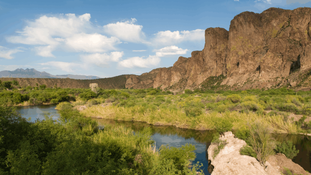
What Makes the Salt River Salty? There are only so few places in the world where one can go rafting on salt water as it’s not exactly a common occurrence to find salty rivers. White water rafting in Arizona is an extremely thrilling and enjoyable experience, one that countless people enjoy every year whether that is by swimming, tubing, kayaking, or doing some Salt River white water rafting. Though, with as many people that enjoy the Arizona’s Salt River, very few actually understand why the fresh water of the Gila River, which turns into the Salt River Tributary, becomes salty to begin with once it leaves the White Mountains. The interesting thing is there is a little known reason as to why, which is even less common throughout the rivers of the world. *Updated for 2026 — Learn why the Salt River in Arizona is salty and how the Tamarisk tree played a pivotal role. Table of Contents The Tamarisk Salt Cedar: The Thirsty Tree The Salt Cedar, also known as the Tamarisk, is a plant that lines the Salt River. It was originally introduced for several good reasons: to prevent topsoil erosion, reduce riverbank erosion, and even slow down evaporation from the river itself. The Tamarisk tree is native to dry climates in the Middle East, Asia, and parts of Africa. When introduced to Arizona, the plant thrived in its new environment, and at first, there were no apparent negative side effects. However, over time, the Tamarisk began to spread uncontrollably, replacing areas where forests of cottonwoods and willows once thrived along the river. These trees were meant to protect the riverbanks and soil, but their introduction would ultimately change the landscape in unexpected ways. What Makes the Salt Cedars Salty The Tamarisk has an incredible ability to draw salt from the earth through its roots. This salt is then stored in the leaves of the tree. As wind blows and rain falls, the salt is knocked off the tree and falls into the river, adding to the saltiness. This process is the key reason the Salt River has its characteristic salty taste, especially in certain sections where the Tamarisk grows abundantly. The Tamarisk tree’s salt-releasing process makes the Salt River one of the few rivers in the world that can claim such unique conditions. A Mistake from Long Ago Farmers and miners thought it was a brilliant idea to introduce the Tamarisk tree. It required little water, preserved topsoil, protected river banks, and even helped to shield crops and homes from wind. Additionally, the trees helped cover the river, theoretically preventing water evaporation. But decades later, the Tamarisk had taken over, and its unchecked spread made it difficult to find any remaining natural vegetation where the Tamarisk thrived. As the Tamarisk spread, experts began to wonder how much water was being lost through the stomata of the Salt Cedars. These trees were clearly using up significant water resources, leading to concerns about the long-term effects on the river ecosystem and water supply. Efforts were made to remove the Salt Cedars, but they were much harder to eliminate than to introduce. The Tamarisk’s seeds would linger in the soil until rain fell, causing new trees to sprout up in place of those that had been removed. This cycle continued for years, creating a persistent problem that took a long time to address. What Scientists Discovered About the Tamarisk In the mid-1980s, scientists discovered an interesting fact: the Tamarisk hadn’t killed off the natural vegetation, as many initially thought. Instead, the local plants died off because they couldn’t survive in the new soil conditions that the Tamarisk altered. Interestingly, where native vegetation had a chance to survive, fewer Tamarisk trees were found. It became clear that the Tamarisk depended on the death of local plants for its survival. The tree was actually doing some positive things too: it preserved the topsoil and prevented riverbank erosion as it thrived in the region. The tree also helped reduce the evaporation of the river more than the amount of water it consumed for its own hydration. So, in the end, we now know that the Tamarisk tree contributed significantly to the formation of the landscape that defines the Salt River. While it wasn’t part of the original ecosystem, it helped shape the river’s salty nature and created the river’s unique features that we enjoy today. Salt River Rafting: A Unique Experience Without the Tamarisk, Arizona rafting on the Salt River would be completely different. The saltiness brought by the Tamarisk gives the river a unique character that sets it apart from other rivers across the world. Whether you’re rafting, tubing, or simply enjoying the landscape, the Salt River offers an unforgettable experience. Wilderness Aware Rafting offers incredible trips on the Salt River, allowing visitors to experience this rare river firsthand. Whether you’re seeking a calm, scenic float or a more thrilling whitewater adventure, the Salt River provides a one-of-a-kind rafting experience, made even more special by its salty waters. FAQ About the Salt River and Tamarisk Tree Why is the Salt River salty? The Salt River’s saltiness comes from the Tamarisk tree, which draws salt from the soil and stores it in its leaves. When the leaves fall or get knocked off by rain or wind, they release the salt into the river, raising the salinity levels. How did the Tamarisk tree affect the Salt River? The Tamarisk tree was introduced to prevent erosion and reduce evaporation. Over time, it became invasive, altering the local vegetation and contributing to the river’s salty water. Why was the Tamarisk tree introduced? Farmers and miners introduced the Tamarisk tree to help protect topsoil, prevent erosion, and slow evaporation. Though it performed these tasks, it spread uncontrollably and altered the river’s ecosystem. Can you raft on the Salt River? Yes, the Salt River is still a popular spot for rafting, tubing, and kayaking. The saltiness of the river adds a unique twist to the experience, making
Exercises to Prepare Yourself for Whitewater Rafting & Other Paddling Sports
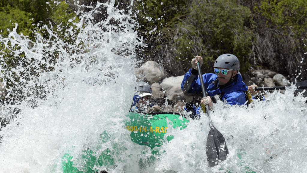
If it’s your first time or your 500th time whitewater rafting, canoeing, kayaking or rowing, preparing your body for the physical stamina and strength required will make your experience more enjoyable and your physique admirable. Similar to any other sport, working out and stretching specific core muscles makes paddling much easier and you’ll be less likely to injure yourself. Although these activities seem to only require your arms and upper body, you’ll actually be using your core a lot if you are paddling efficiently and to maintain your balance. Some people mistakenly focus only on their upper body and forget about their bottom half—Pro Tip: don’t forget to work out your legs since you only need them to hold up your upper half. Increasing Endurance Whitewater rafting, kayaking, and other paddling adventures require sustained energy and cardiovascular fitness. Without a strong endurance base, you’ll tire quickly and may struggle to keep pace with your group. The good news? You can train for it off the water with simple, effective workouts that boost stamina and heart health. Endurance Tips for Rafters and Kayakers: Incorporate Cardio Cross-Training: Biking, running, swimming, and rowing are all excellent low-impact ways to build cardiovascular endurance. Add Intensity with Intervals: Mix in short bursts like 30-second sprints, uphill climbs, or circuit-style training to push your aerobic capacity. Start Small, Then Build: Begin with just five minutes of steady cardio, and increase duration gradually as your stamina improves. Hydrate Before You Train: Pre-hydration is key—drink water beforehand to keep your body performing well throughout your workout. Fuel with Smart Carbs: Eat complex carbs like oatmeal, whole grain toast, or Greek yogurt with fruit before your session for sustained energy. Recover with Protein: After your workout, refuel with protein-rich snacks like a smoothie, peanut butter and banana, or a protein shake to aid recovery and muscle repair. Training your cardiovascular system before hitting the water ensures you’ll be ready to paddle strong, without gassing out in the first rapid. Increasing Strength Building strength is crucial for paddling power, endurance, and injury prevention. “Strength training is a key component of overall health and fitness for everyone,” and it “can also protect your joints from injury,” according to the Mayo Clinic. The more strength you have, the more water you can pull with each stroke—and your team will be counting on you to pull your weight. Whitewater rafting and kayaking rely heavily on your shoulders, arms, wrists, and core, so it’s important to get these muscle groups used to repetitive motion. Targeted strength training improves control, boosts stamina, and helps prevent common injuries like shoulder strain from overexertion. Top Strength Exercises for Rafters: Push-Ups: Strengthen your chest, shoulders, and triceps while engaging your core. Pull-Ups or Rows: Develop back and arm muscles for stronger strokes and better posture. Overhead Press: Boost shoulder endurance for long paddling days. Planks: Build core stability, which helps with balance and bracing in the raft. Tricep Dips: Improve arm control for quick, precise movements. Aim to train 2–3 times per week using bodyweight or light weights. Focus on form and endurance over heavy lifting. Strong muscles won’t just improve your performance—they’ll help prevent injury and keep you paddling longer. Prior to strength building, consume some low GI carbs and protein like a spinach and egg omelet or a smoothie with protein powder. Always pre-hydrate. Follow up your exercises with a chocolate protein shake or half of an avocado with cheese and tomato and a healthy serving of water. Increase Flexibility Building strength and endurance is essential—but it won’t mean much if an injury takes you off the water. To stay healthy and paddle-ready, flexibility and proper recovery are just as important. Incorporating dynamic warm-ups, cooldown stretching, and good hydration habits can go a long way in preventing cramps, strains, and fatigue. Stretching and Injury Prevention Tips: Warm Up First: Get your body moving with 5 minutes of light cardio before stretching—this helps loosen muscles and prevents strain. Stretch During Cooldowns: After workouts, dedicate time to slow, controlled stretching to increase flexibility and reduce soreness. Target Key Areas: Focus on shoulders, arms, back, and hips—muscles most used in paddling. Cross-body arm stretches and shoulder rolls are especially effective. Improve Posture: Standing and sitting with good posture keeps your spine aligned, engages your core, and prevents lower back discomfort during long paddling sessions. Hydrate to Prevent Cramps: Not drinking enough water before or after activity can lead to muscle cramps and fatigue, so keep that water bottle handy. Adding flexibility and recovery practices to your training routine helps you stay limber, reduce your risk of injury, and show up ready for adventure every time you hit the river. Heading to the Water Before you jump right into the water, take a moment to warm up your muscles whether it’s jogging, sprints, or lunges. Then stretch your shoulders, arms, wrists, legs, and back. This way, your muscles are loose and ready to rock and roll. Make sure your reusable water bottle is filled, you’ve had a few swigs of that, and your snack is safe in your belly. Protect your skin by applying a water-resistant sunscreen to prevent painful burns from the sun reflecting off the water. If you’re wearing sunglasses (recommended), use a strap on the arms so you don’t risk losing them if they fall off. Lastly, get your helmet and life jacket on, have fun and enjoy whitewater rafting, kayaking, canoeing or rowing as you’re feeling stronger and more flexible. Check out the white water rafting trips we have available at Wilderness Aware Rafting or contact us for more information. See you on the river! FAQ’s for Preparing Yourself for Whitewater Rafting Why is strength training important for whitewater rafting? Strength training builds the upper body and core muscles needed for powerful, controlled paddling. It also helps prevent injuries like shoulder strain by preparing your muscles for the repetitive motions of rafting. What are the best exercises to prepare for paddling sports? Effective exercises include
8 Facts You Didn’t Know About the Arkansas River
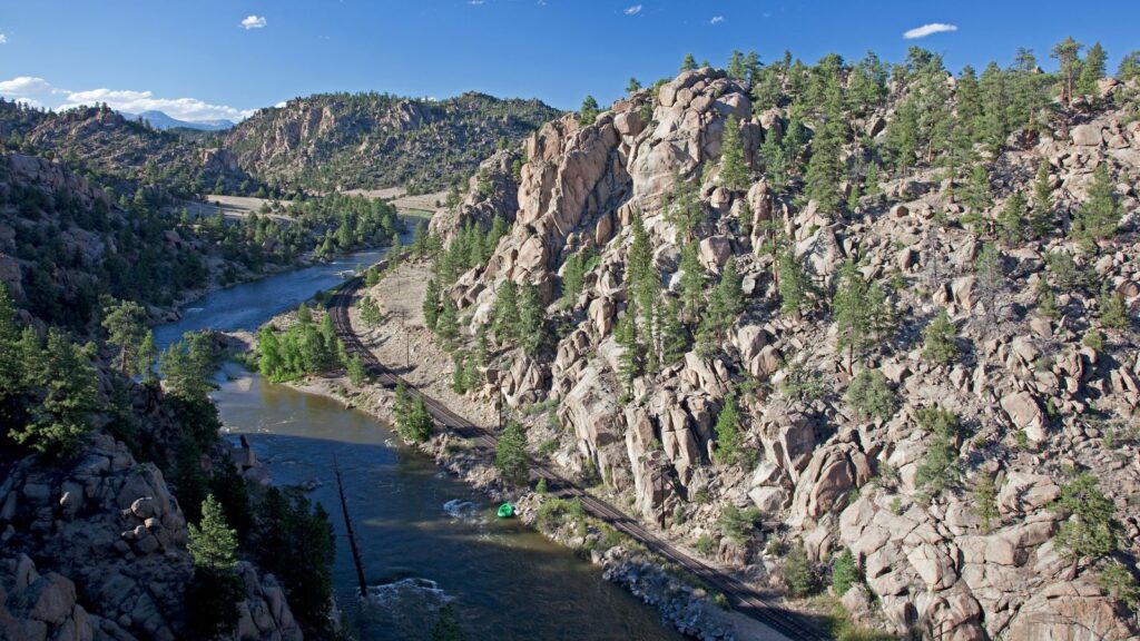
Published: April 25, 2025 | Updated: February 2026 Facts about the Arkansas River are as fascinating as the thrilling rapids it offers. This iconic waterway has played a key role in shaping both American history and the landscape of modern adventure. While many are familiar with the Arkansas River for its world-class rafting, few know about its rich historical significance and unique geological features. Since 1976, Wilderness Aware Rafting has been navigating these waters, gaining deep knowledge of the river’s currents, history, and hidden treasures. From early exploration and settlement to the powerful rapids of today, here are eight surprising facts about the Arkansas River. Table of Contents 1. It Was Once Part of the U.S.-Mexico Border From 1819 to 1848, the Arkansas River served as the official boundary between the United States and Spanish-controlled Mexico. After the Treaty of Guadalupe Hidalgo, the U.S. expanded, and the river no longer marked the border, but its historical significance remained. 2. A Gateway for the Gold Rush During the 1859 Colorado Gold Rush, prospectors followed the Arkansas River into the Rocky Mountains in search of fortune. The river became a critical travel route, leading settlers toward what is now Leadville, Colorado, a major mining town. 3. It’s the Sixth-Longest River in the U.S. Spanning 1,469 miles, the Arkansas River originates in the Sawatch Range of Colorado and flows through Kansas, Oklahoma, and Arkansas before joining the Mississippi River. 4. Steamboats Once Traveled Its Waters In the 1800s, steamboats navigated the lower Arkansas River, transporting goods and people deep into the heart of the frontier. However, the river’s unpredictable water levels made it difficult for consistent travel, limiting its long-term use for shipping. 5. It Played a Role in the Railroad Boom The Arkansas River became a battleground for railroad companies in the late 1800s. The Royal Gorge War was a heated conflict between the Atchison, Topeka & Santa Fe Railway and the Denver & Rio Grande Railroad, both fighting for the rights to lay tracks through the Royal Gorge for better access to the mining towns of Colorado. 6. It’s the Most Popular Whitewater Rafting Destination in America The Arkansas Headwaters Recreation Area (AHRA) is one of the most popular whitewater rafting destinations in the country. Featuring legendary rapids like Browns Canyon, The Numbers, and Royal Gorge, the river attracts thrill-seekers from around the world. 7. Indigenous Tribes Relied on the River for Centuries Long before European exploration, the Ute, Pawnee, Osage, and Comanche tribes depended on the Arkansas River for food, trade, and travel. The river played a crucial role in sustaining indigenous communities throughout the region. 8. The River’s Name Comes from Native American Origins The name “Arkansas” originates from the French pronunciation of the word used by the Quapaw tribe, a Native American group that lived near the river’s mouth. Early French explorers documented their name for the region, and it eventually became associated with the river itself. Why the Arkansas River is Unique for Rafting Unlike many other rivers in the West, the Arkansas River features a “steep drop” profile. It drops nearly 5,000 feet in its first 125 miles. This creates a high concentration of rapids, which is why Arkansas River rafting is considered the gold standard for Colorado whitewater. Frequently Asked Questions About The Arkansas River Where does the Arkansas River start and end? The Arkansas River begins at its headwaters near Leadville, Colorado, in the Sawatch Range of the Rocky Mountains. It flows approximately 1,469 miles southeast through Kansas and Oklahoma before reaching its mouth at the Mississippi River in eastern Arkansas. How did the Arkansas River get its name? The name “Arkansas” is a French interpretation of the word “Akansa,” which was the name used by the Quapaw people who lived near the river’s mouth. Early French explorers like Marquette and Jolliet documented the name in the 1670s, and it eventually became the official designation for the entire Arkansas River corridor. Why is the Arkansas River so popular for whitewater rafting? The Arkansas River is the most popular rafting destination in America because of its unique geology. It drops nearly 5,000 feet in its first 125 miles, creating a high density of Class III to Class V rapids. The river offers diverse sections like Browns Canyon for families and the Royal Gorge for advanced thrill-seekers. What is the best time of year to visit the Arkansas River in Colorado? For whitewater rafting, the best time to visit the Arkansas River is between May and Labor Day. Peak “high water” typically occurs in June due to snowmelt, while July and August offer warmer weather and more technical, family-friendly flows through sections like Bighorn Sheep Canyon. The Arkansas River begins at its headwaters near Leadville, Colorado, in the Sawatch Range of the Rocky Mountains. It flows approximately 1,469 miles southeast through Kansas and Oklahoma before reaching its mouth at the Mississippi River in eastern Arkansas. The name “Arkansas” is a French interpretation of the word “Akansa,” which was the name used by the Quapaw people who lived near the river’s mouth. Early French explorers like Marquette and Jolliet documented the name in the 1670s, and it eventually became the official designation for the entire Arkansas River corridor. The Arkansas River is the most popular rafting destination in America because of its unique geology. It drops nearly 5,000 feet in its first 125 miles, creating a high density of Class III to Class V rapids. The river offers diverse sections like Browns Canyon for families and the Royal Gorge for advanced thrill-seekers. For whitewater rafting, the best time to visit the Arkansas River is between May and Labor Day. Peak “high water” typically occurs in June due to snowmelt, while July and August offer warmer weather and more technical, family-friendly flows through sections like Bighorn Sheep Canyon. At Wilderness Aware Rafting, we don’t just run trips on the Arkansas River—we live and breathe the Arkansas River’s history. Our guides are not just fun, engaging and high
How to Adjust to Altitude Changes (and Not Get Sick)
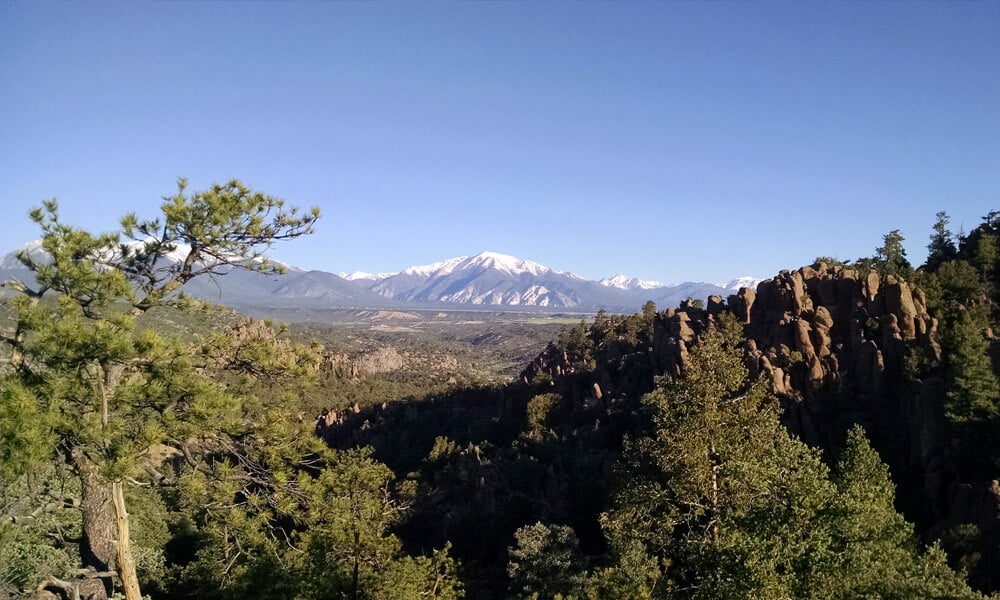
Wondering how to adjust to altitude sickness and not get sick? We’ve got 9 tips to help you adjust to altitude and stay healthy at higher elevations. From boosting your water intake and getting plenty of rest to easing into physical activity and increasing your potassium levels, these simple steps can help reduce your chances of getting sick. Keep reading for the full list! Table of Contents There’s no need to end the fun and leave the mountain to alleviate your altitude sickness – this handy guide will help! Here’s how to adjust to altitude changes so you can focus on enjoying your trip. You don’t have to hit the slopes or visit Peru to start feeling the pain from altitude sickness. Whether it’s shortness of breath, nausea, or exhaustion, it can totally wreck your trip. Here’s how you can adjust to altitude quickly and safely, so you can get on to having an amazing trip. What is Altitude Sickness? As you’re going higher in elevation, you start taking less oxygen per breath – this causes altitude sickness. According to the CDC, “If you plan to travel to an elevation higher than 8,000 feet above sea level or higher, you may be at risk for altitude illness, which is caused by low oxygen levels in the air.” – Center for Disease Control and Prevention The process starts at around 5,000 feet, and as you go higher (about 9,800 feet), the odds of experiencing altitude sickness increase substantially. At that altitude, about 75% of people will feel some symptoms. If you’ve never experienced a substantial gain in elevation, chances are you’ll notice some changes in how you’re feeling. Thankfully, there are ways to prepare your body for adjusting smoothly. One thing to note: it’s not just going to these heights that causes the problem – it’s caused more by the speed of ascent. The best way to avoid altitude sickness is to gain elevation slowly, which allows your body to acclimate to the change in elevation. How Long Does It Take to Adjust to Altitude Changes? Your body can take a few days—or even a couple of weeks—to fully adjust to higher altitudes. How long it takes depends on a few things: How high you’re going Your personal genetics Your fitness level How fast you climbed to that altitude What Type of Symptoms Might I Experience? Fortunately, serious symptoms like High Altitude Pulmonary Edema (HAPE) or High Altitude Cerebral Edema (HACE) only happen at extremely high altitudes, far higher than most people will ever go. You are more likely going to experience milder symptoms such as shortness of breath, headaches, and other annoying (but certainly not debilitating) symptoms. How to Adjust to Altitude 1. Drink Lots of Water As you gain altitude, your body tends to lose water and salt faster than you’re used to. When combined with the dry air and physical activity a trip to Colorado usually involves, it’s no wonder dehydration is such a problem. Many of the symptoms of altitude sickness mirror those of dehydration, so consistently drinking water throughout the day goes a long way to getting you acclimatized quickly. 2. Reduce Your Exercise As you gain elevation, the air gets thinner so each breath you draw contains less oxygen. Over time, your body strengthens and adjusts to accommodate this, which is why endurance athletes often train at extremely high altitudes in places such as Peru or Nepal. In the short term, however, your cardiovascular system is working harder. Each breath contains less oxygen, so each heartbeat contains less oxygen, making your heart beat faster. In other words, your body is working harder to do the same thing you would do at sea level. In order to give your body time to adjust, it’s best to take it easy for a few days when you first get to 5,000+ feet. After a few days of moderate activity, you’ll be ready to ramp back up to full throttle. 3. Get Enough Sleep One of the symptoms of altitude sickness is insomnia, so it can be hard to get enough rest. However, a good night’s sleep can do wonders to help you kick the problem. One common suggestion is descending to a lower elevation (if possible) to sleep at night. If this isn’t an option, it’s best just to push on and get through the first few days of acclimation. Don’t underestimate the power of a little cat nap if you can sneak one in during your day! 4. Limit Your Alcohol Intake Alcohol hits a lot harder when you’re trying to acclimatize, so the best thing you can do is take it easy and not drink your first few nights in town. Alcohol often replicates many of the symptoms of altitude sickness (nausea, dizziness, fatigue, light-headedness) so it’s a bit like doubling down on your body in terms of a negative impact. Another reason to lay off on drinking is because of the general challenge it is to stay hydrated while acclimatizing to a higher altitude. Alcohol dehydrates you, so consuming it only worsens your hydration situation. Your safest option is waiting 48 hours before you hit the bars. After this period, you should be acclimatized enough to handle the effects of drinking at altitude. 5. Increase Your Potassium Levels Potassium loss is a pretty standard symptom if you’re feeling dehydrated from the dry air at elevation. It can be a major pain – literally. Muscle cramping is commonly associated with low potassium levels. Fortunately, it’s an easy nutrient to replace. Foods like bananas, avocados, spinach, yogurt, and kale are all high in potassium so getting enough without supplements shouldn’t be too hard (even for the pickiest of picky eaters). 6. Protect Yourself From the Sun At altitude, the air is thinner and as a result, there’s more exposure to the sun. Denver, for example, with an altitude of only one mile (5,280 feet), receives 25% less natural protection from the sun than you’d find at