Explore the twists and turns of the Dolores River with our detailed river map. Navigate your adventure through serene landscapes and challenging rapids, ensuring a thrilling journey from start to finish. Perfect for planning your next rafting or kayaking trip, this map provides essential information on river routes, access points, and key features along the way.
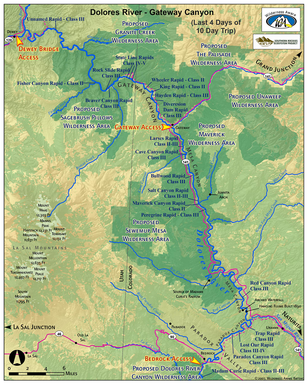
Gateway Canyon Map
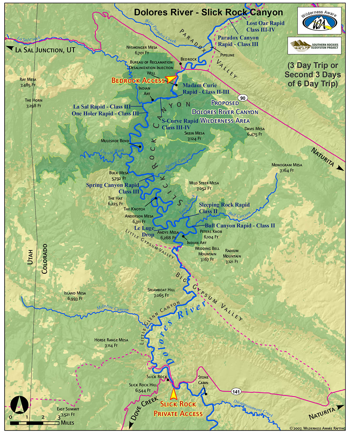
Slick Rock Canyon Map
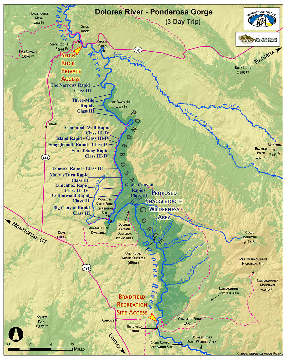
Ponderosa Gorge Map
SPOTS ARE FILLING FAST!
BOOK YOUR TRIP NOW
Choose from a variety of Colorado rivers, day trips, and multi-day trips to find just the right option for you and your crew. Better hustle, because they’re booking up quick!