Calm float section
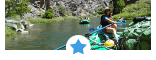
Lower Gore Canyon
Search Our Trips:
lower gore canyon overview
Although a long stretch, there are several access points on this section allowing you to modify the length of your trip. What this section lacks in rapids it makes up for with great fishing, campgrounds and smaller crowds.
Recommended Trips on Lower Gore Canyon – Upper Colorado River:
Trip Name: Lower Gore Canyon
Sections Included: Lower Gore Canyon
Outfitter: Sage Outdoor Adventures
Learn More: sageoutdooradventures.com ~ 970.476.3700
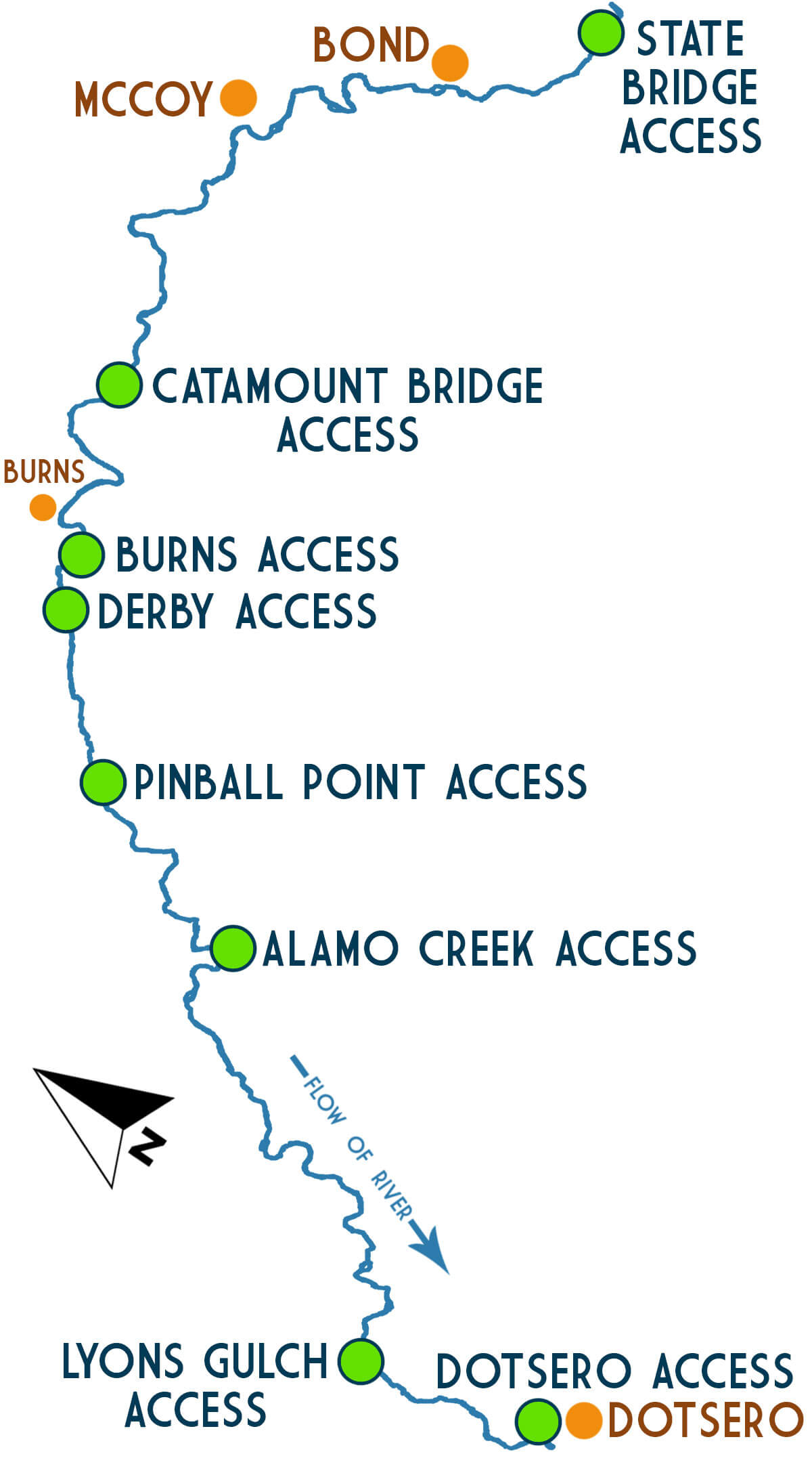
lower gore canyon sections
Upper Colorado River – Little Gore Canyon Whitewater Rafting Details:
Difficulty: Class I-II (What does this mean?)
Elevation: 6746′ to 6129′
Average Gradient: 14.3′ per mile
Access to Access
State Bridge to Catamount Bridge: 14 miles
Catamount Bridge to Burns: 5 miles
Burns to Derby: 1 miles
Derby to Pinball Point: 2.5 miles
Pinball Point to Alamo Creek: 5.5 miles
Alamo Creek to Lyons Gulch: 11 miles
Lyons Gulch to Dotsero: 4 miles
Total Mileage: 43 miles
reviews

What people are saying
resources
Information for Upper Colorado River Self-Guided Boaters:
The Upper Colorado River (Lower Gore, Dotsero and South Canyon) are managed by the Bureau of Land Management out of Silt, CO.
- Boating Permit Required: NO
- Permit Details: No fee of any kind is required to float the river, but you do need to buy a pass to use the BLM managed and private access sites.
- River Manager: U.S Bureau of Land Management – Colorado River Valley Field Office
2300 River Frontage Road, Silt, CO 81652
970.876.9000 ~ www.blm.gov/co/st/en/fo/crvfo.html
Shuttles:
Please contact the river manager (above) for information on shuttles.